 Aggregate Intellect
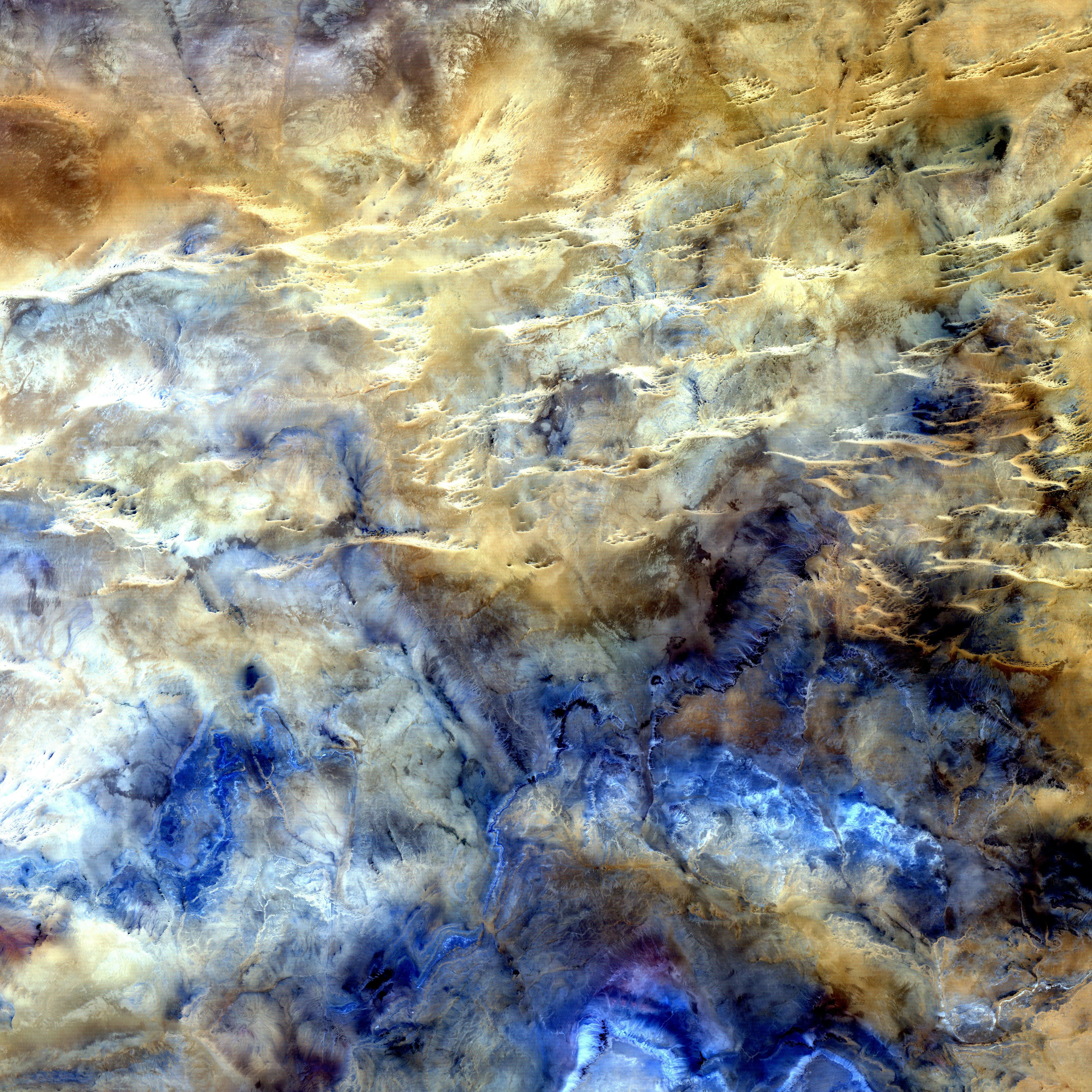
The Problem
High resolution satellite products provide detailed snapshots of the Earth’s surface. In this working group, our community members examined the capabilities multiple ML techniques trained on Sentinel-2 data to develop accurate and robust land cover classification algorithm across Canada.
Working Group Leads / Advisors

~ Fraser King | Lead
PhD.c @ University of Waterloo, Canada


Dr Andre Erler | Advisor
~ Senior Climate Scientist at Aquanty
Project Recipe
At Aggregate Intellect, we’re contextualizing the world’s technical knowledge! Find below the 25+ resources used to build out this project - contextualized & commented. If you felt it empowered you to build using cool new tech, thank us by telling a friend!
Data
Resulting Project Code & Sample
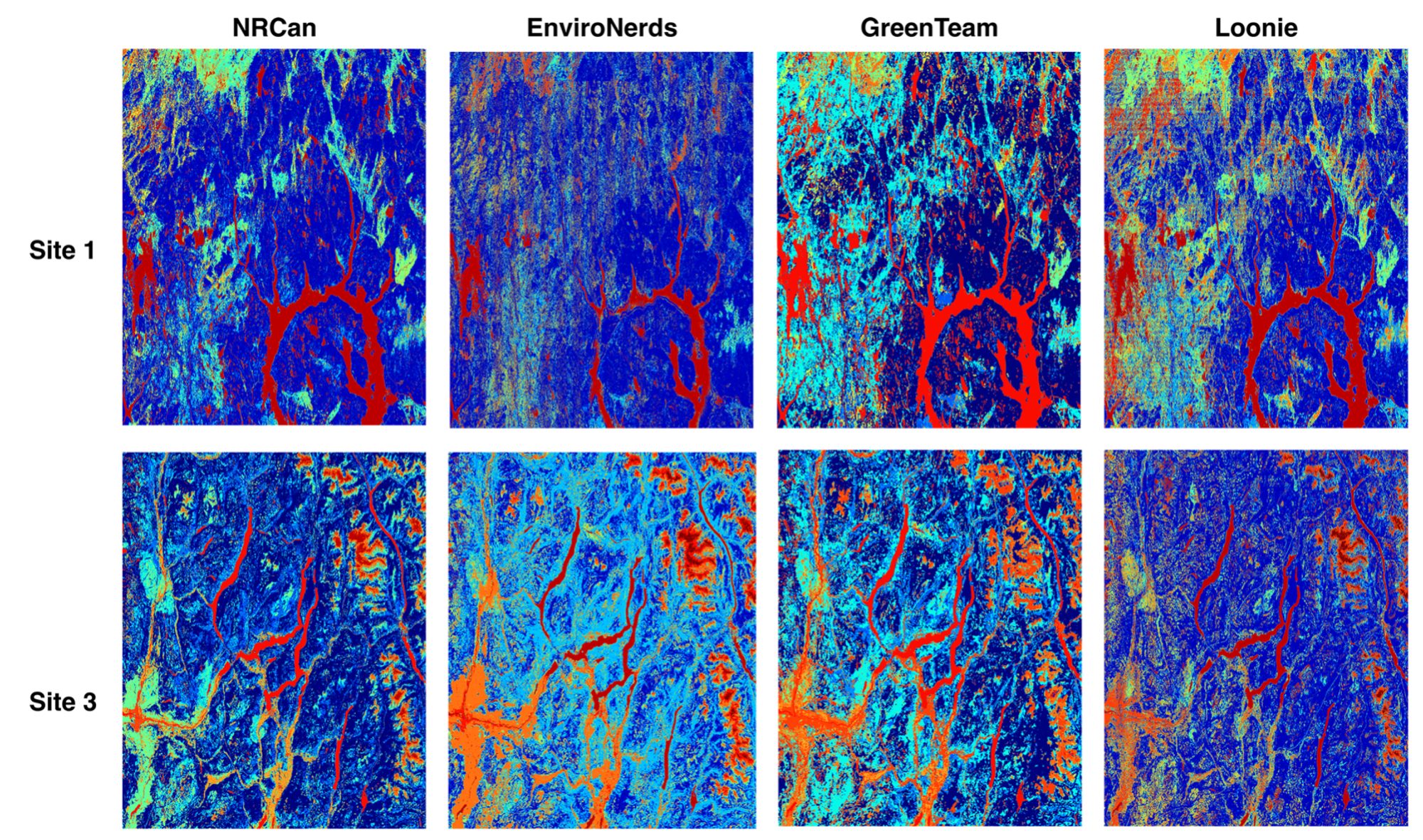
Winners / Contributors
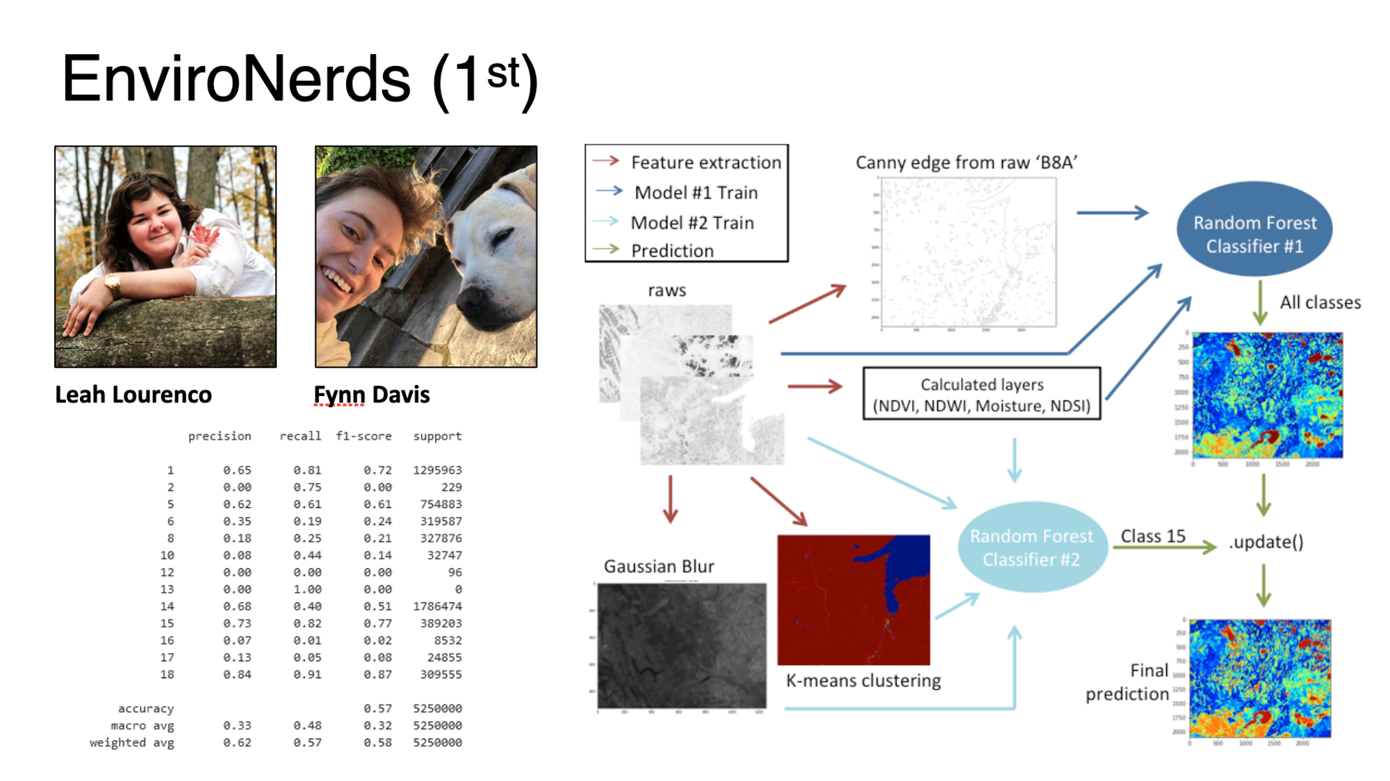
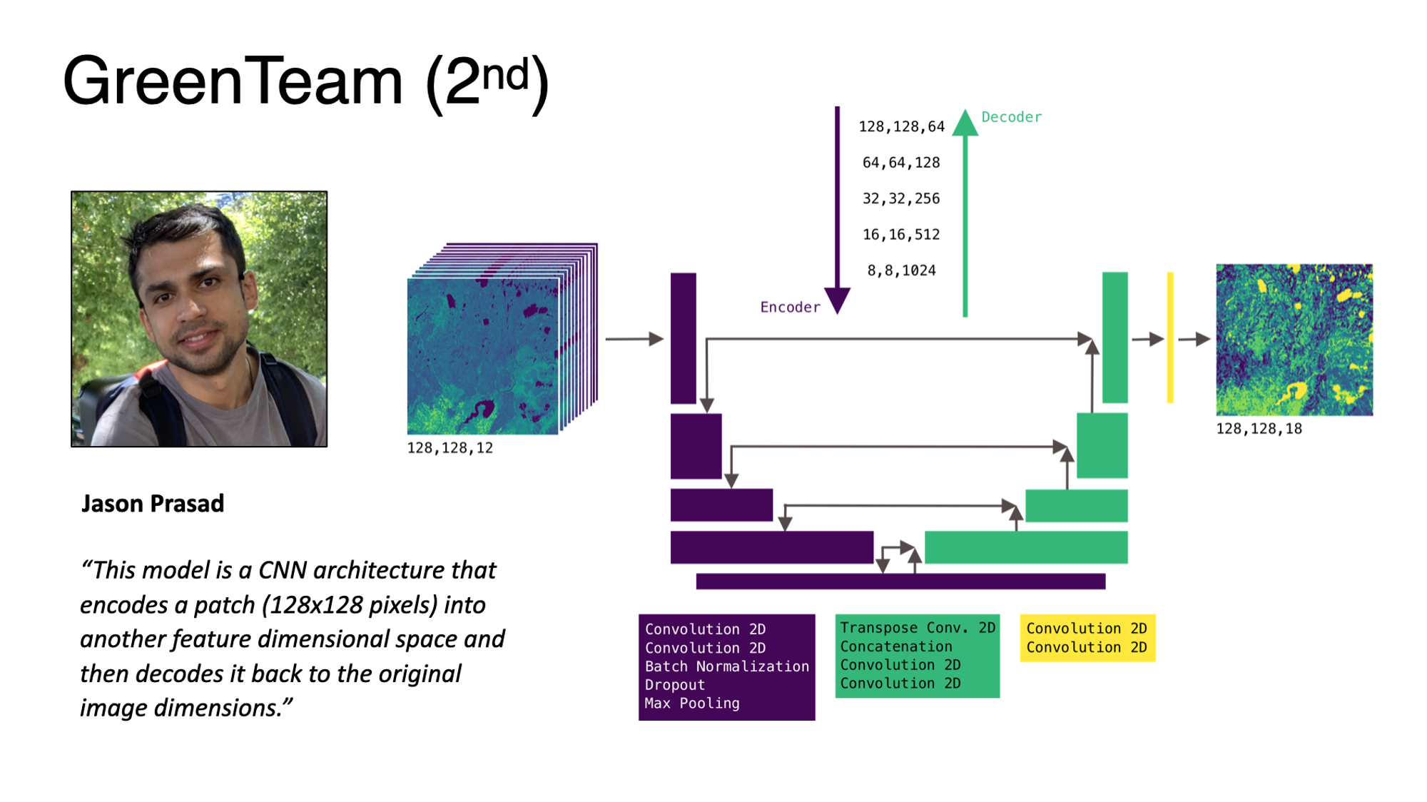
LinkedIn: Jason
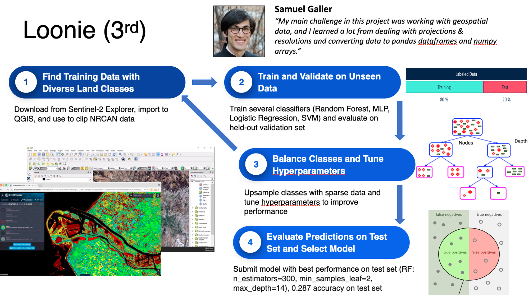
LinkedIn: Samuel
Others who reached the minimal goal
Team Jungle: Sajad yazdanparast, Afshin Amini
Team JP: Paola Andrea, Juan Manuel
Sponsor
Due to the generosity of our sponsor, we were able to give over $4000 in gifts & prizes to participants, leads & advisors.